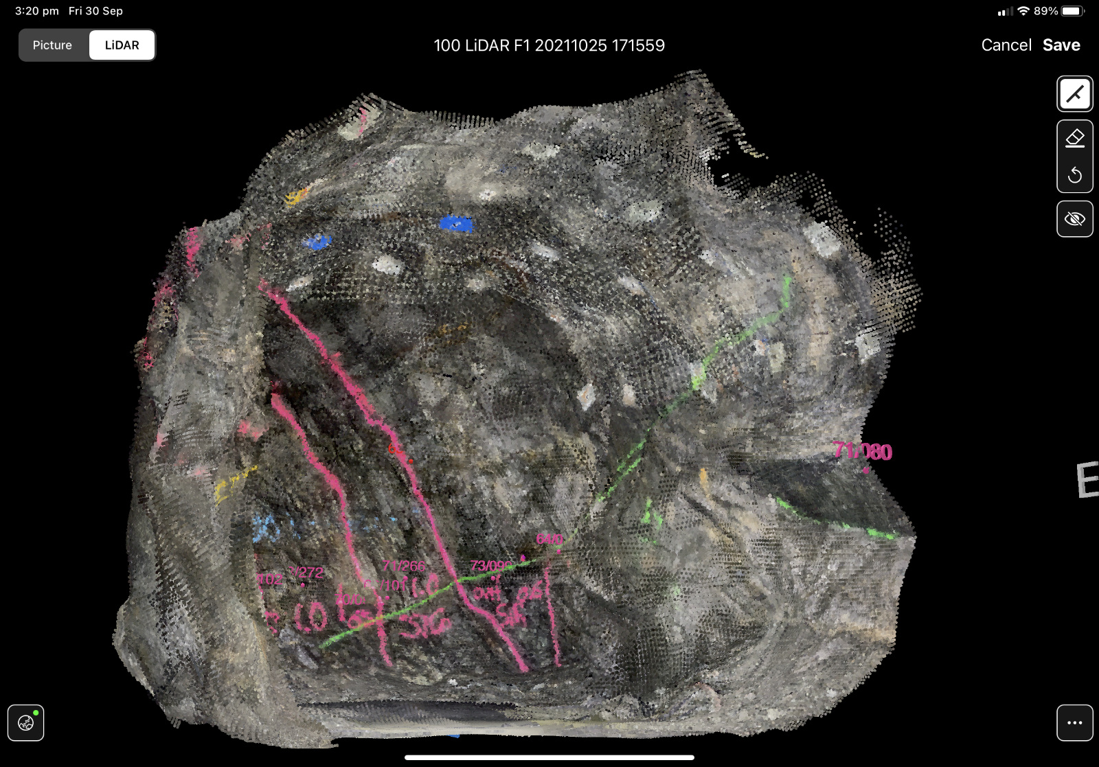
Capture 3D point clouds OR 3D textured meshes of rock faces with the iPad Pro.
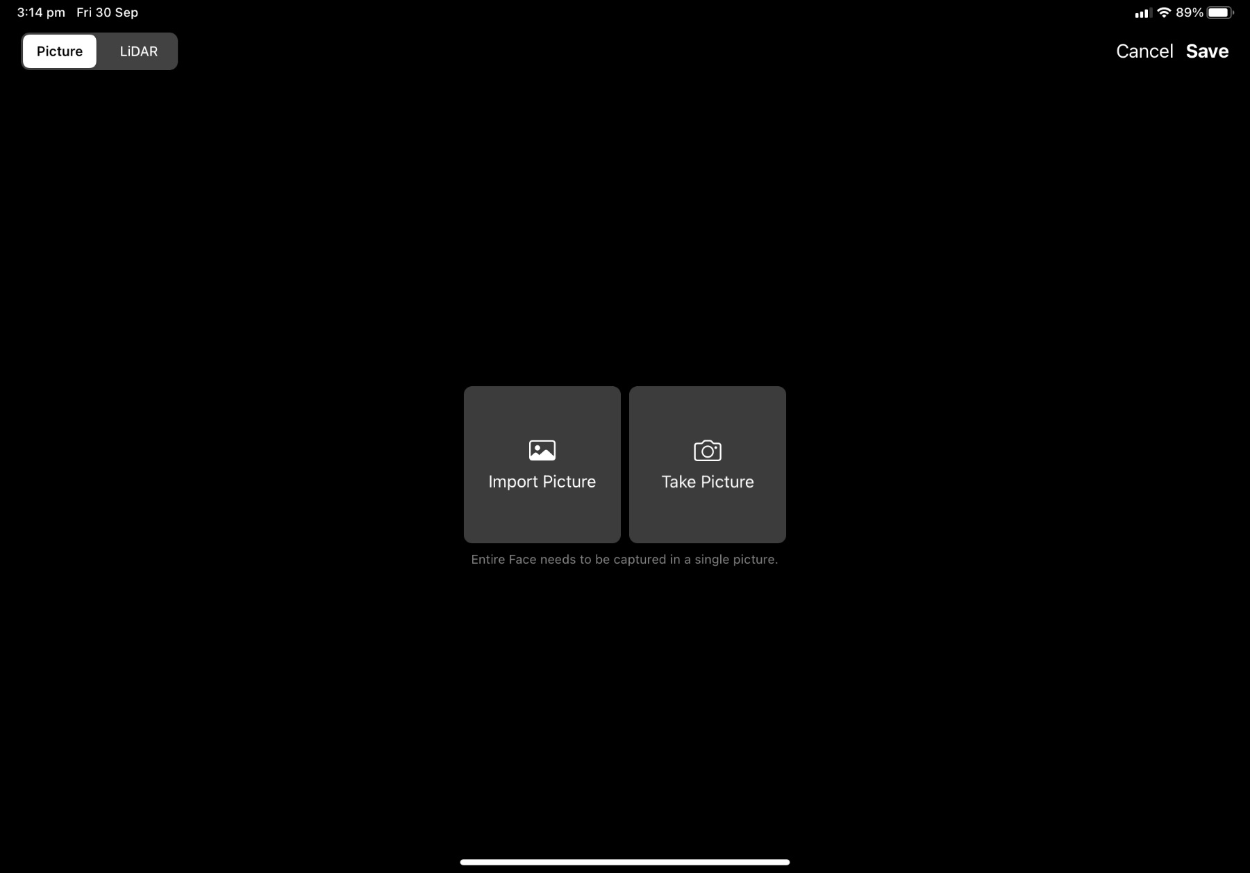
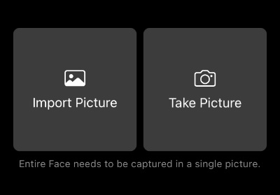
Take high quality rock face photographs using the iPad`s built-in camera.
Georeference LiDAR scans and photographs based on a single laser station or reference point.
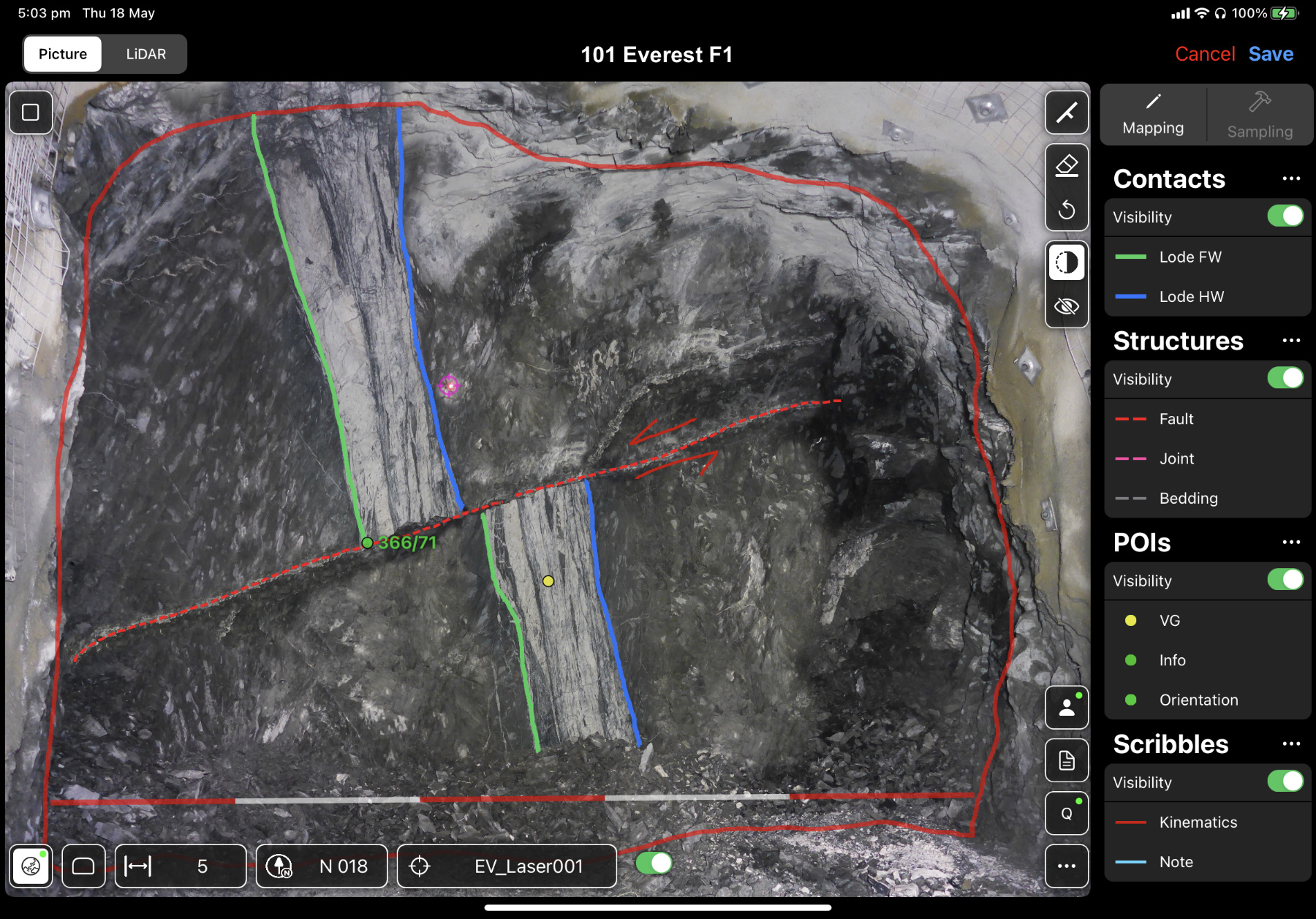
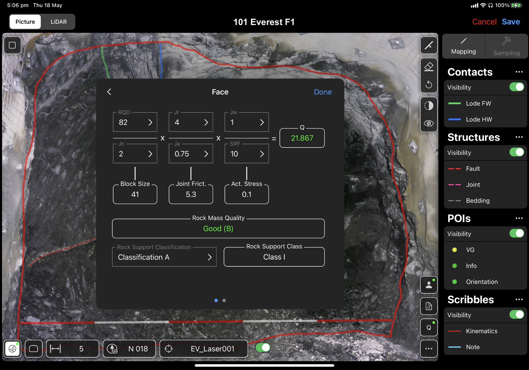
Annotate onto georeferenced rock face photographs using freely customisable mapping layers.
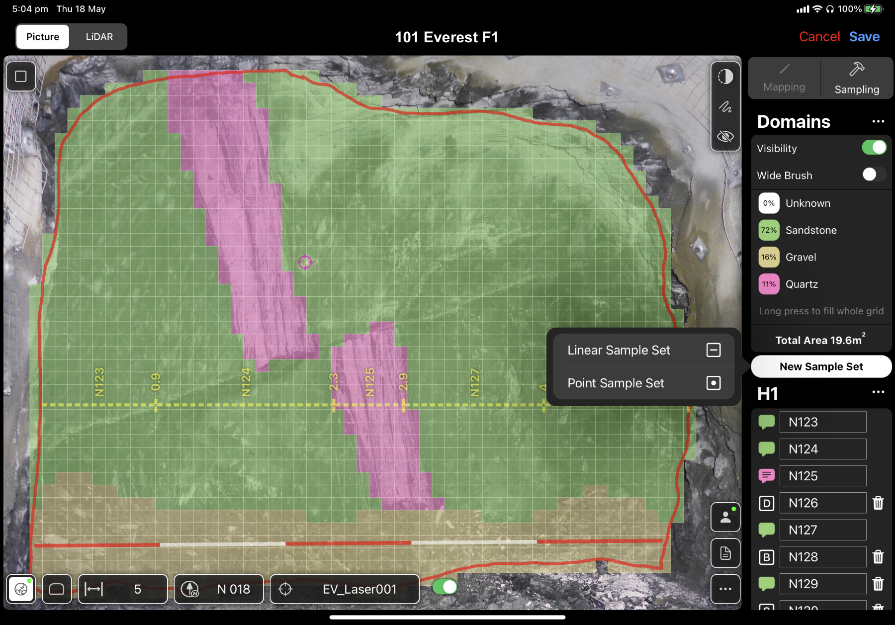
Mark samples on rock face photographs and add Blanks, Duplicates & Standards in record time.
Auto-generated PDF reports. No more manual compiling of reports later in the office.
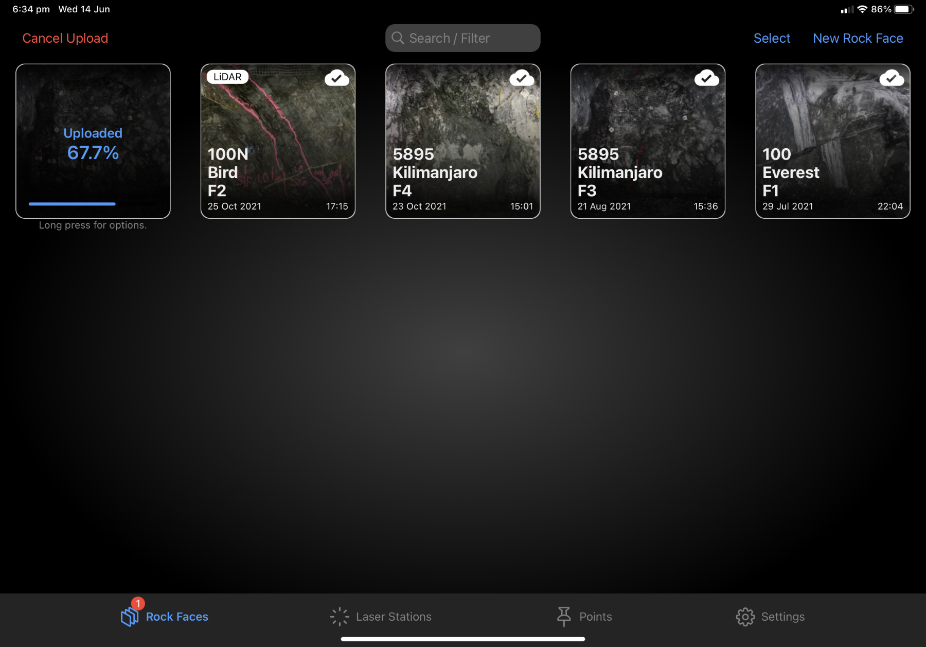
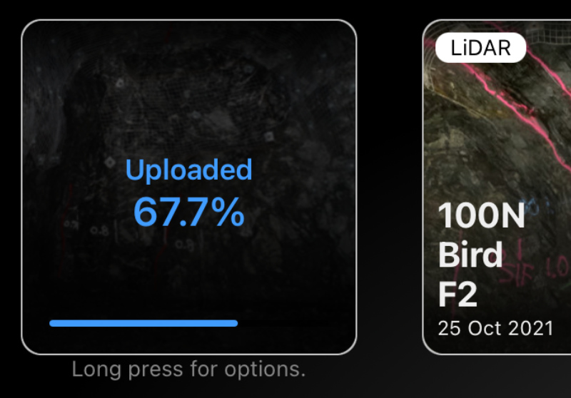
Easy data transfer. Press Upload and all data is forwarded to your cloud account within seconds.
Wirelessly exchange projects & settings between devices. Sharing has never been easier.
Handwriting gets magically converted to typed text. Powered by Artificial Intelligence.
Shallow learning curve & easy to integrate into existing geology workflows.
Subscription billed per mine (no user limit) plus inexpensive hardware.
Rock Mapper gets better over time as new features are developed and integrated.
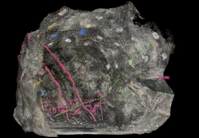
3D Point Clouds
Rock Face Photographs
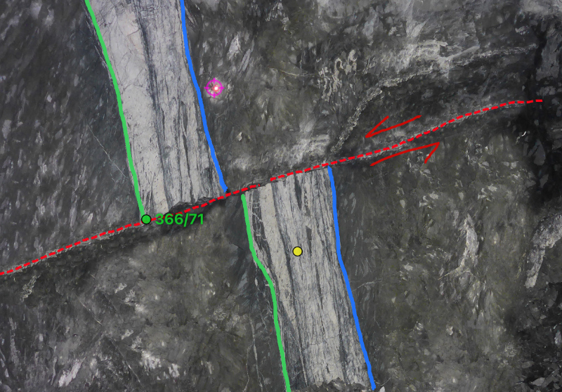
Geological Features
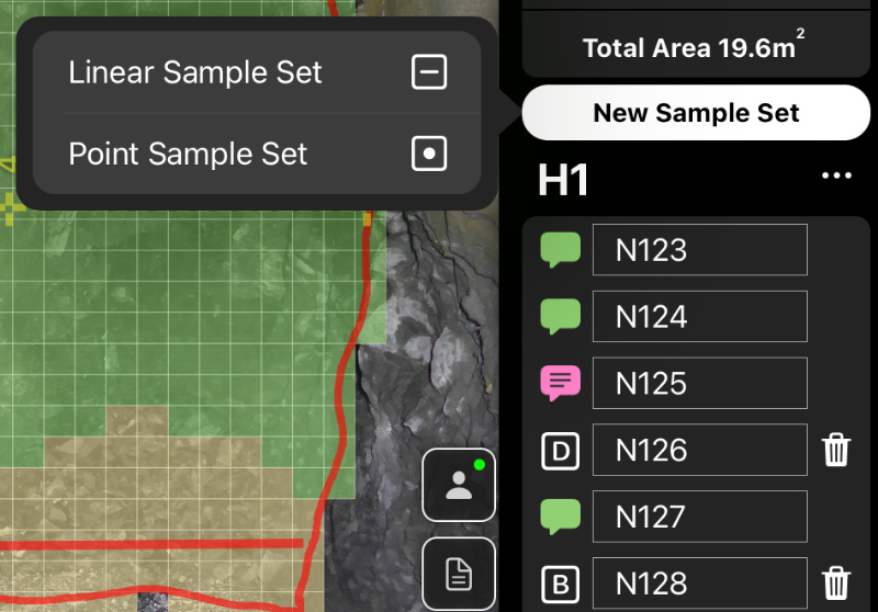
Grade Control Samples
Georeferenced Datasets
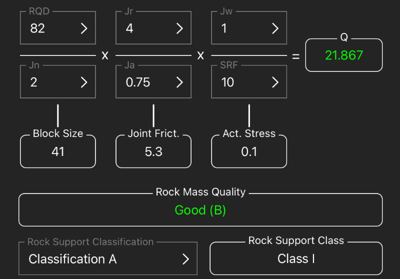
Rock Mass Assessment

David (programmer) and Stefan (geologist) chat about the concept of Rock Mapper after a Beach Road bike ride in Melbourne.
The initial concept was quite basic, but we soon added more advanced features. Extensive field tests allowed us to develop & implement practical workflows that users love.
First public release of Rock Mapper on the Apple App Store. A big day that we were looking forward to for years.

The very positive feedback prompted us to finally set up a proper business structure to be able to commercially interact with our clients.

Entering a niche market as a small company is a challenge. We were very pleased to see the quick uptake of Rock Mapper in the mining industry by our valued early adopters.
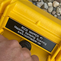
A new and custom-designed, waterproof LED light array that is attached to the iPad Pro. Optimised for LiDAR scanning & face photography. All gear packed into a sturdy & compact case.
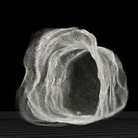
Rock Mapper is entering another dimension. Democratizing LiDAR and enabling the acquisition of georeferenced 3D point clouds by making use of the iPad`s LiDAR sensor.
Walls and Roof mapping. The smart georeferencing workflow allows for automatic 3D registration of roof and wall maps based on the reference info on the face photograph.
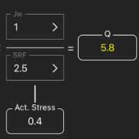
Rock Mapper is going geotechnical. A dedicated tool for rock mass assessment using Q System allows for a powerful and streamlined workflow.
Big LiDAR Upgrade plus new Augmented Reality (AR) Tool. Use LiDAR to generate 3D textured meshes and view them in AR.

Co-Founder & Structural Geologist

The Code Cat

Co-Founder & Programmer
Rock Mapper is used by Clients & Partners around the Globe